The Most Complete Set of Tools for Land Development
Land Takeoffs isn't just a map app. It's a full land development platform — six purpose-built tools that take you from finding a site to closing the deal, built specifically for serious land teams.
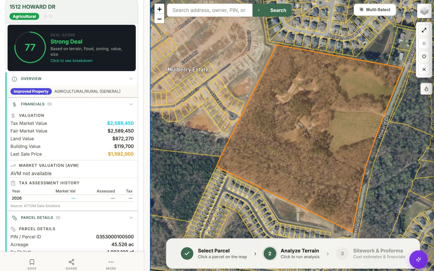
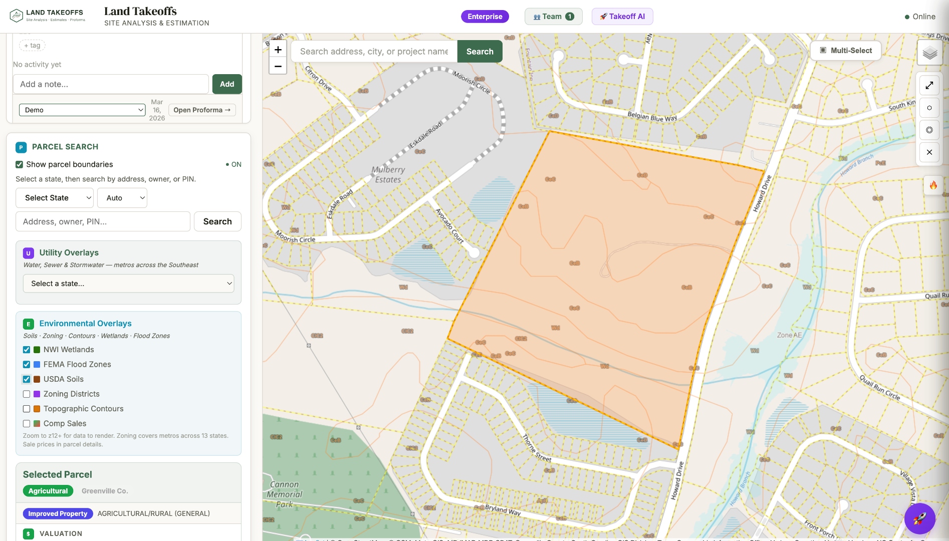
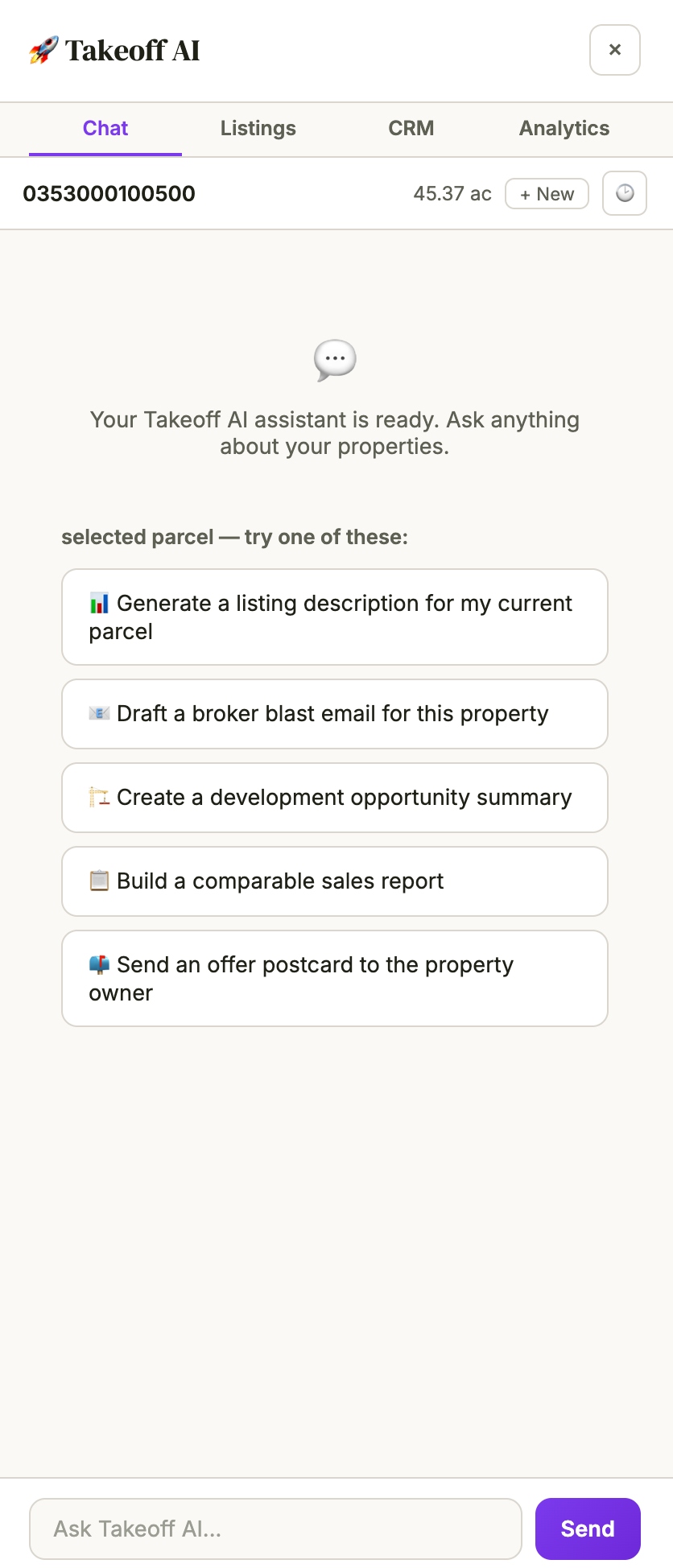
GIS Map
Explore parcels, draw boundaries, and analyze any site nationwide on the interactive map — owner data, terrain, utilities, flood, wetlands, and zoning layered in one view.
Open map
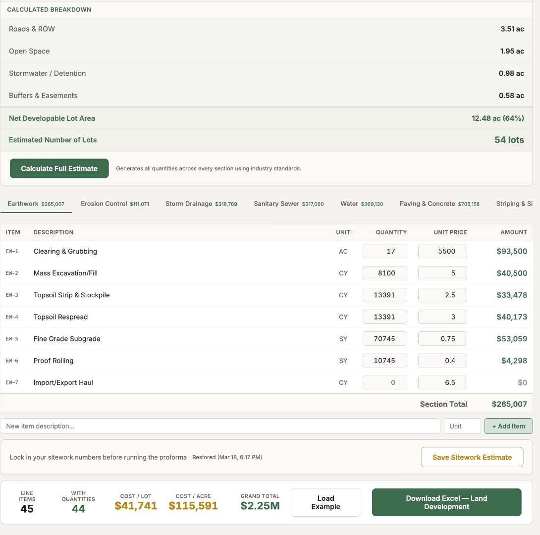
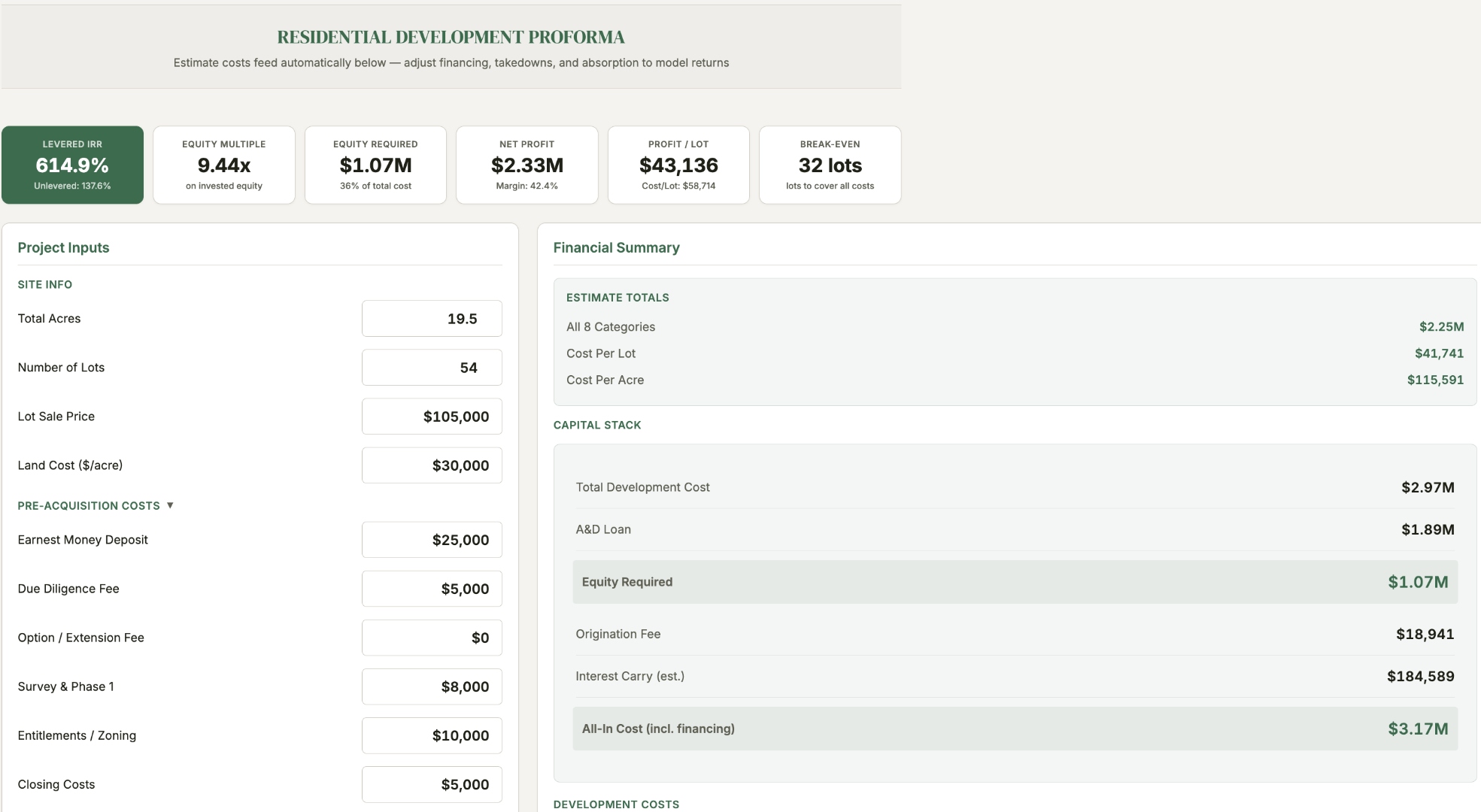
Sitework Estimate & Proforma
Build grading and sitework takeoffs, then run the deal proforma from one workspace — line-item costs flow straight into levered IRR, profit per lot, and break-even.
Build estimateClear Site Report
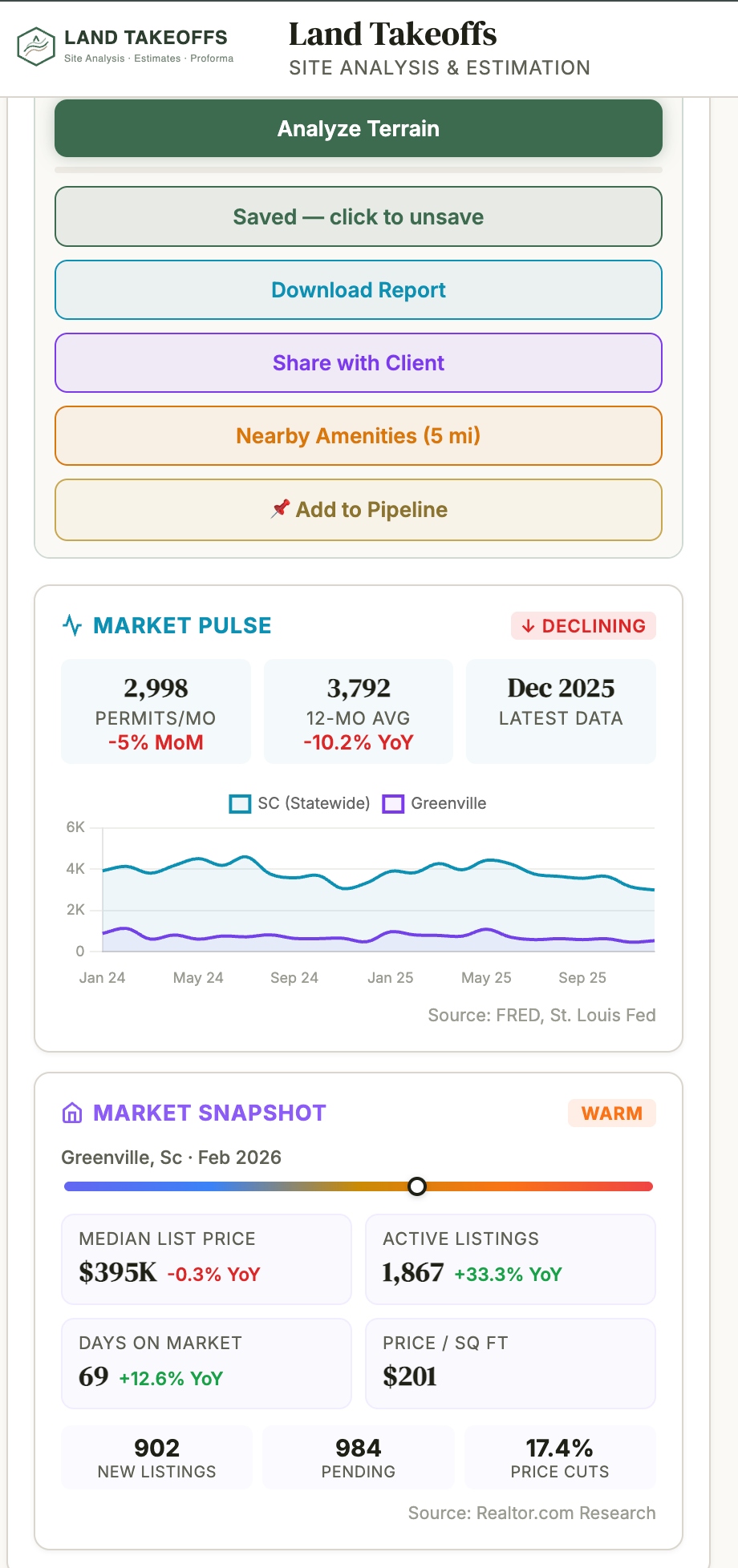
Generate clean, shareable due-diligence reports for every deal in your pipeline — constraints, buildability, and the full site story in one branded document.
Open report
County Intelligence
Track subdivision pipelines, sources, and development activity across counties — understand county risk and momentum before you commit capital.
View intelligencePlan Check Review
Our proprietary intelligence tool reads your development plans and produces comments aligned with your county or city plan review. Know the comments before the delays.
Coming soonProject Database
Save your pricing, standards, and project history so our intelligence tools save you time on every future project. Your numbers, reused everywhere.
Coming soon